How to Perform Forest Habitat Value Assessments and Determine Forest Protection Levels in Accordance with the New Castle County UDC
New Castle County (NCC) recently revised their Unified Development Code (UDC) forest protection regulations to expand the methods and means in determining forest cover types which include habitat values and protection levels. The previous regulations provided protection to forested areas and large trees, but focused heavily on canopy cover and general definitions rather than habitat value and data collection methods. The new regulations incorporate additional factors and values into the process now referred to as a “Forest Habitat Value Assessment.” Results are math-based, so subjectivity is significantly reduced and results can be reproduced or verified from the field data.
These new regulations may seem complicated at first with the detailed processes and data collections, but any good consultant that can identify plants and measure trees should be able to develop a procedure to perform Forest Habitat Value Assessments with realistic outcomes.
Forest Protection Levels (FPLs)
The previous regulations required protection levels for specimen trees (large trees not in a forest setting) and for young and mature forests based on zoning, and required mitigation where limits or percentages were exceeded. The new regulations retain protection and replacement standards but have replaced the “young forest” and “mature forest” designations with Forest Protection Levels (FPLs) that classify forest areas as Tier 1, Tier 2, and Tier 3 based on Total Habitat Value Points (THVPs). The new forest protection regulations also include these factors:
- Critical Natural Areas (CNAs): Sites listed in the State natural areas inventory (administered by DNREC Division of Parks & Recreation; State Office of Nature Preserves) deemed worthy of future conservation.
- Critical Root Zones (CRZs): The protected areas around the base of a tree containing shallow roots that supply nutrients and water to the tree; typically limited to the upper 12-18 inches of soil. CRZs can be determined by physically surveying the drip line, or calculated by using 1.5 feet of radius for every inch of the tree DBH (diameter at breast height).
When is a Forest Habitat Value Assessment (FHVA) Needed?
A Forest Habitat Value Assessment is now required wherever a proposed disturbance will occur within 50 feet of the Critical Root Zone or drip line of a forested area. A Forest Habitat Value Assessment is not required if the forest area is less than 0.5 acres.
Five Main Phases of a FHVA
The Forest Habitat Value Assessment for a subject property consists of five main phases:
1 – The first phase is to conduct a preliminary Forest Stand Delineation (FSD).
This consists of reviewing historical aerial photos to estimate different forest cover types, potential specimen trees, small stands and fragmented forests, and interior forest areas on the subject property. The acreages of all potential forest cover types are estimated to determine the number of sample plots for data collection in the field. One sample plot is required for the first three acres plus an additional plot for every two additional acres.
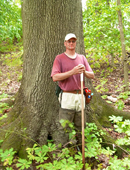
2 – The second phase consists of conducting a field investigation to verify the preliminary FSD conditions, make any necessary adjustments, and to document the on-site conditions.
All large eligible potential specimen trees are identified, measured, and located by GPS or survey. Sample plots are established within the forested areas and the appropriate data is collected and recorded within each forest layer. All non-forest cover types are documented.
3 – The third phase is processing the field data.
Sample plot data is tabulated to assign points to calculate the THVP which determines the FPL for each sample plot. Points are given for three categories in the upper canopy: Large Trees (>18” DBH), Value Trees (UDC List), and Added Value Trees (Beech, Oak, Hickory). Value Tree points are also given where they occur in the lower canopy, shrub layers, and herbaceous layer. Additional points are given for mature forest areas (woodland areas ≥0.2 acres dominated by trees greater than 18” DBH) and forest interiors (high-value secluded habitats ≥ 0.2 acres deep within woodlands ≥ 300 feet in from the forest edge). The Floristic Quality Index (FQI) is an additional factor based on every species that occurs in each sample plot. The UD Flora of Delaware online database has assigned a C-Value to every regional species; these C-Values range from high numbers for valuable and uncommon species down to zero for non-native and invasive species. The FQI is the sum of the C-Values divided by the number of species in the plot.
Determining Forest Protection Levels (FPL)
The sum of all the points (Large Trees + Value Trees + Added Value Trees + Interior Forest Area + Mature Forest Area + FQI) equals the THVP at each plot which determines the FPL:
FPL CRITERIA FOREST QUALITY Tier 1 ≥52 Total Habitat Value Points High: Mature high-value trees, native species Tier 2 26-51 Total Habitat Value Points Medium: Typical woodlands with some non-natives Tier 3 1-25 Total Habitat Value Points Low: Common trees, invasives and non-natives
4 – The fourth phase is plan development.
The Forest Habitat Value Assessment (FHVA) Plan is a scaled drawing that accurately depicts all forest cover types; identifies each FPL and acreages; locates all sample plots; denotes the drip line or CRZ; locates forest interiors; and identifies all specimen trees. In addition, the plan must include non-forest cover types and descriptions; small tree stands; zoning designations; property boundaries; existing features such as structures and roads; easements and rights-of-way; proposed development; forested areas and acreages proposed to be cleared; and any proposed mitigation areas deemed necessary.
5 – The fifth phase is a narrative.
A narrative report accompanies the FHVA Plan and describes the subject property, the proposed project, data collection methods, site-specific information, data sheets, maps and figures, and site photographs.
Forested areas that can be cleared for development are percentage-based and dependent on (1) the Forest Protection Level, (2) the zoning of the subject property, and (3) the presence of a CNA.
In addition, potential specimen trees are verified by comparing their sizes with the UDC criteria, and non-forest areas and small tree stands are documented.
Contact Landmark Science & Engineering
Please contact Craig Smith or your Project Manager at Landmark Science & Engineering if you have any questions or need us to conduct a Forest Habitat Value Assessment on your project.
Craig Smith is an environmental scientist with Landmark Science & Engineering, a Professional Wetland Scientist (PWS), and MD DNR-Qualified Forest Professional with over 28 years of relevant experience. <click link for more about Craig Smith>